ROADTRIPS
AITOLOAKARNANIA
AITOLOAKARNANIA
A wonderful one-day route in Etoloakarnania 200 km
Patra → K. Vassiliki → Limnopoula → Panagia Panaxiotissa → Gate of the Holy City of Messolonghi → Tourlid Beach → Aetoliko → Thermo → Nafpaktos → Patra
DELPHI
DELPHI
A wonderful one-day trip to Delphi 250 km
Patra → Monastiraki → Glyfada (Trizonia) → Galaxidi → Ancient Theater of Delphi → Patra
ZAROUCHLA GOURA
ZAROUCHLA GOURA
A wonderful one-day route to mountainous Achaia and Corinthia 248 km
Patra → Tsivlou Lake → Zarouchla → Doxa Dam → Goura → Derveni → Akrata Beach → Diakopto Beach → Patra
Corinthia
Corinthia
A wonderful one-day route to Corinthia 327 km
Patra → Xylokastro Beach → Vrachati Beach → Loutraki → Vouliagmeni Lake → Gulf of Heraion → Corinth Canal → Pegasus Statue, Corinth → Patra
KALAVRYTA
KALAVRYTA
A wonderful one-day route to Kalavrita 209 km
Patra → Chalandritsa → Pieros Paraperios Dam → Hero of the Revolutionary Fighters → Kalavryta → Veranda → Bank Beach → Patras
PREFECTURES & TRIPS
A beautiful prefecture in the north-western Peloponnese that combines mountain and sea and is attractive in all seasons of the year. In close proximity, just 2 hours from Athens, is an area with an important history from antiquity that goes all the way to Byzantium and the Ottoman Empire. Its capital is Patras, which is the 3rd largest city in the country.
Kalavrita
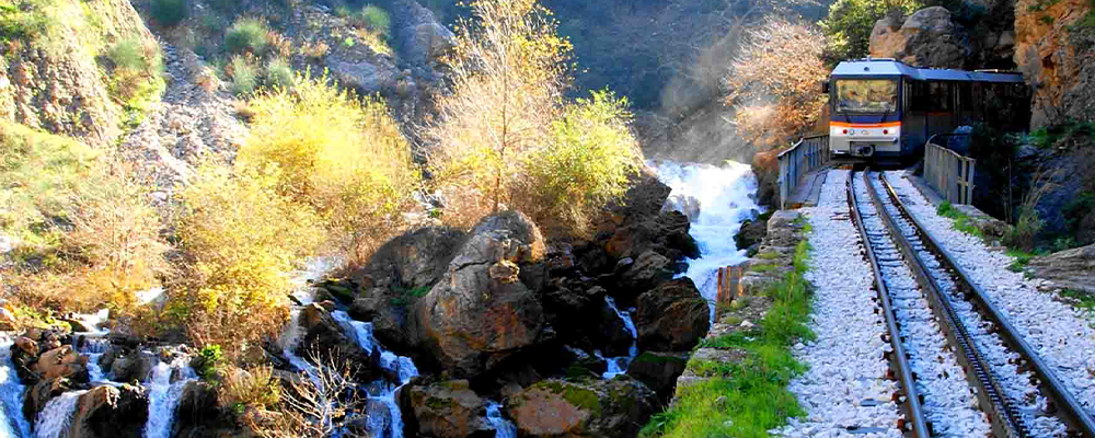
The well-known Kalavryta is located at the foot of Mount Helmos in the western part of the Prefecture. The tour of the city starts from the Kalavryta Railway Station where Odontotos ends. Continuing along the pedestrian street, we come across the central square with the beautiful Church of the Dormition and the Holocaust Museum with the statue of the woman dragging her dead husband after the violent invasion of the Germans in December 1943. The town of Kalavryta has been characterized as martyrdom since in 1943 the Germans during the Second World War exterminated 50% of the males of the Municipality.
Kato Zachlorou Achaia
Taking the cogwheel ( odontotos ) from Kalavryta to Diakopto, the first stop is in a magnificent landscape in Kato Zachlorou. Beneath the plane trees, the Mega Cave station emerges with various taverns with traditional delicacies under the shade of the plane trees.
Planeterio of Achaia
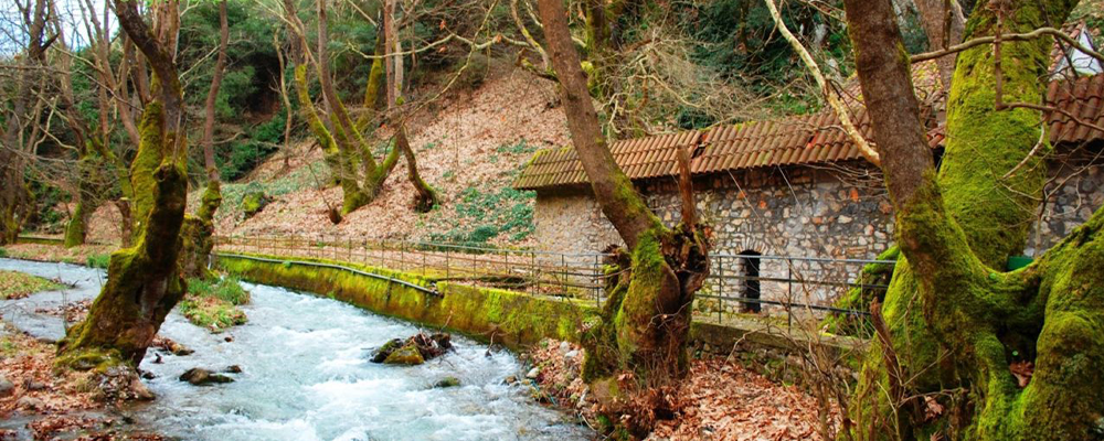
A magical place south of Kalavryta near the popular cave of the Lakes. Planitero is a traditional village “washed” by its towering plane trees.
Rio
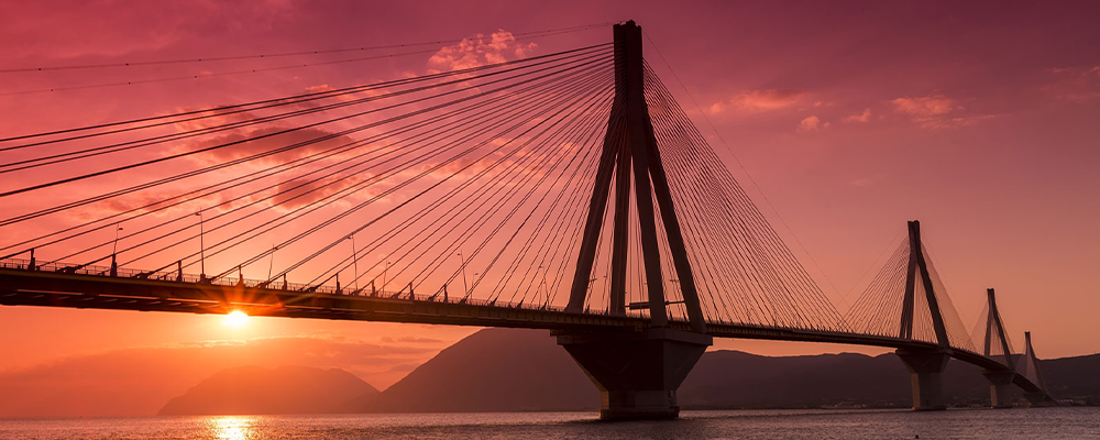
One of the largest bridges in Europe, a special construction worth seeing and admiring. Of course this excursion would be ideal with a visit to the castle of Rio which is a popular attraction of the prefecture. In the afternoon it is worth enjoying the sunset on the beach of Agios Vassiliou or in the shops of Rio on Posidonos Street.
Kalogria Beach & Strofylia Forest
We could also call it an African savanna ending in a “small” Sahara overlooking the Ionian Sea! How about a swim in the most beautiful beach of Achaia, 30 kilometers from Patras?
Hiking in Erymanthos
If you are a fan of hiking, we recommend a beautiful excursion to Alpine Erymanthos. With a height of about 2,300 meters, the historic mountain of Achaia offers us a scene taken from a movie in the Alps. If you reach the top, the view is breathtaking and reaches as far as Pyrgos and Patras.
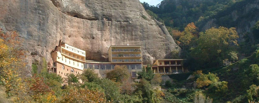
Great Cave
This magnificent monastery should not be missed. It is located 15 kilometers from Kalavryta to Diakopto. It is built inside the Rock and is worth visiting.
Agia Lavra
A circular monastery built at the foot of Helmos which during the Greek Revolution functioned as a hidden school. It is located at a distance of 6 kilometers from Kalavrita!
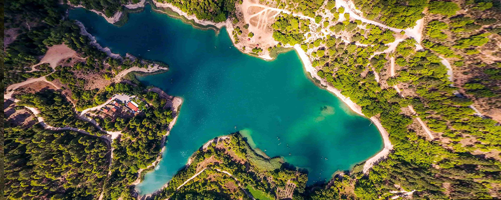
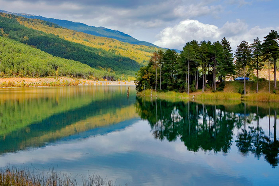
Lake Tsivlou
Scenes from an Alpine landscape at a distance of 3 hours from Athens, just 20 kilometers away from Akrata! The lake is artificial and at its bottom are the ruins of the old village of the area!
Panachaikos
If you’re from Patras, a short climb to Panachaikos will be all you need to enjoy the magnificent view that stretches all the way to Agrinio and Aigio! A beautiful mountain, ideal for hiking and cycling in the fir trees and pure oxygen!
The Prefecture of Ilia was one of the 51 prefectures of Greece, while since 2011 it is the Regional Unit of Ilia, one of the 74 regional units of the country and is administratively subordinate to the Region of Western Greece.
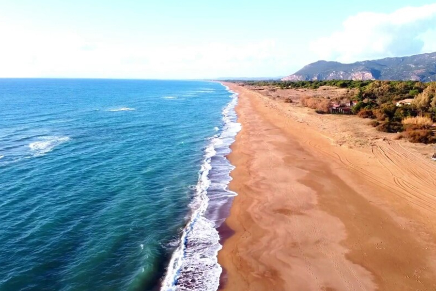
The wonderful natural coasts feature coves, with the most important and beautiful being Kaiafa beach and further north Arkoudi, Glyfa, Bouka and Manolada. In general, the natural environment of the prefecture is characterized by a rich variety of flora and fauna, pine forests and cypresses in the semi-mountainous and lowlands, while picturesque villages spread throughout the prefecture.
Pyrgos
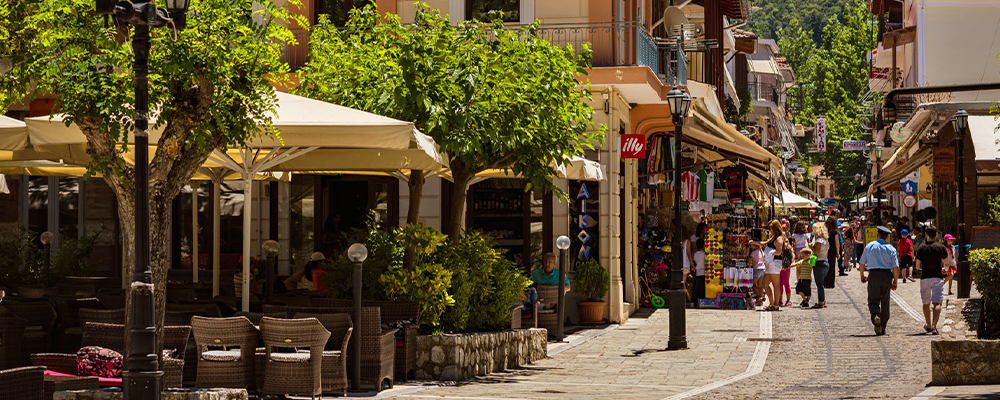
Pyrgos is the capital of Ilia Prefecture. The city owes its name to a high tower built by Ioannis Chernotas. It has been known by this name since 1687. The biggest attractions are two exquisite neoclassical buildings designed by Ziller, the Municipal Agora and the Apollonian Municipal Theater. In the afternoons, the inhabitants of this small town gather in the cobbled Central Square with its cafes and pastry shops. In the narrow alleys, small taverns and grills serve local delicacies and tasty snacks from the fertile land of Ilia.
Amaliada
Amaliada is the first city in area and the second in population. In 1924, the town with 10,490 inhabitants was mentioned for the first time. Some of the wonderful beaches of Amaliada are Kourouta, Paluki, Savalia and Douneika. Also worth visiting is the monastery of Panagia in Fragavila, which dates back to the 11th century, and the monastery of the Assumption with its panoramic view of the city of Amaliada.
Zaharo
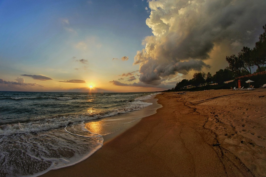
Zaharo is green and the trees reach all the way to the beach. Shortly after Zacharo, we will meet Caiaphas, an area well known for its thermal baths. Zaharo is surrounded by pine and olive trees that reach to the huge beach with white sand and crystal clear waters. The beach of Zaharos is the longest in Europe, more than 60km of white sand. With its economic prosperity and its tourist infrastructure (hotels, restaurants, taverns, municipal tourist kiosks next to the sea, etc.) it offers excellent accommodation and living conditions. It can satisfy any visitor looking for a comfortable, pleasant, carefree vacation in one of the most beautiful summer resorts.
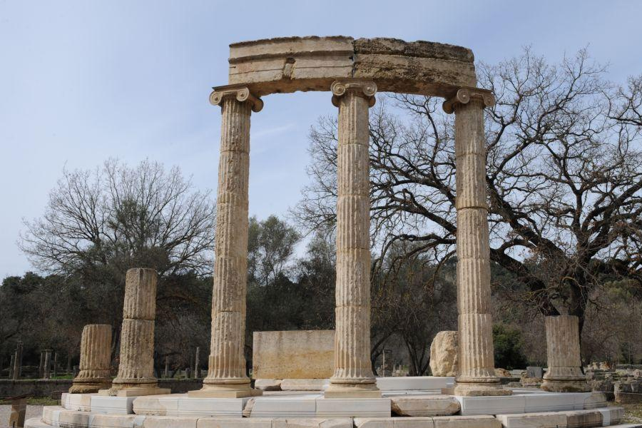
Ancient Olympia
There is one of the most important Sanctuaries of Antiquity, dedicated to the father of the gods, Olympian Zeus. Olympia is the place where the Olympic Games were born and held in ancient times. During their conduct there was the so-called sacred truce during which all hostilities between the Greek city-states were suspended for a month. The first Olympiad is held in 776 BC.
Excavations at Olympia began in May 1829, two years after the naval battle of Navarino, by French archaeologists. The findings (parts of the metopes of the pronaus and the opisthodome of the temple of Zeus) were transferred to the Louvre Museum, where they are exhibited today. When the Greek government was informed of the looting of the finds, the excavations were interrupted to be resumed later, in 1875 by German archaeologists. Research continues to this day by the German Archaeological Institute of Athens under the supervision of the Ephorate of Antiquities of Olympia.
The Sanctuary of Olympia lies on the southern foothills of the wooded hill of Kronius, between the confluence of the Alpheus and Kladeos rivers. The valley between the two rivers in ancient times was overgrown with wild olives, poplars, oaks, pines and plane trees, that is why the Sanctuary was called ΄Altis, i.e. a grove. Alti is surrounded by a precinct within which are included the main religious buildings and votive offerings of the sanctuary. Outside the precinct were the auxiliary areas, that is, the residences of the priests, the baths, the preparation areas for the athletes, and the guesthouses.
In the various museums that exist inside Olympia, the Olympic games museum, the old Olympia museum and the new archaeological museum, one can see either findings discovered during the excavations at the place where the games took place, or the Bronze Age and the historical of the excavation, either material covering the games up to 1906 and a related stamp collection.
Foloi Dry Forest
The forest of Foloi. It was named after the centaur Pholos. According to legend, Folos hosted Heracles when he was trying to track down the Erymanthian Boar. The wine which Pholos treated Heracles became the cause of a battle with the rest of the Centaurs in the course of which Pholos was killed by Heracles’ arrow, which accidentally hit him.
The Foloi oak forest extends within the catchment basins of the Erymanthos rivers to the east, which is also the natural boundary between Ilia and Arcadia and the Homeric river Selleenta. southwest. It is the only oak forest in the Balkans, one of the largest in Europe with an area of 42,000 hectares and included in the Natura 2000 network. According to the locals, there are 5 million trees in the forest, the vast majority of them are “hats”, as they call the oak. There is no point in starting to count, accept this number and enjoy their magnificence.
The forest is located on a plateau, at an altitude of 660 meters. It is flat which makes it an ideal destination for hiking and visitable throughout the year. It is one of the oldest forests in Europe, perhaps because oak does not burn as easily as pine. Thus, last summer while there were fires in the wider area. this wonderful ecosystem was saved.
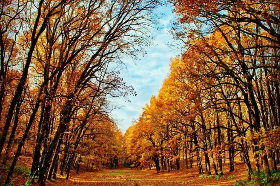
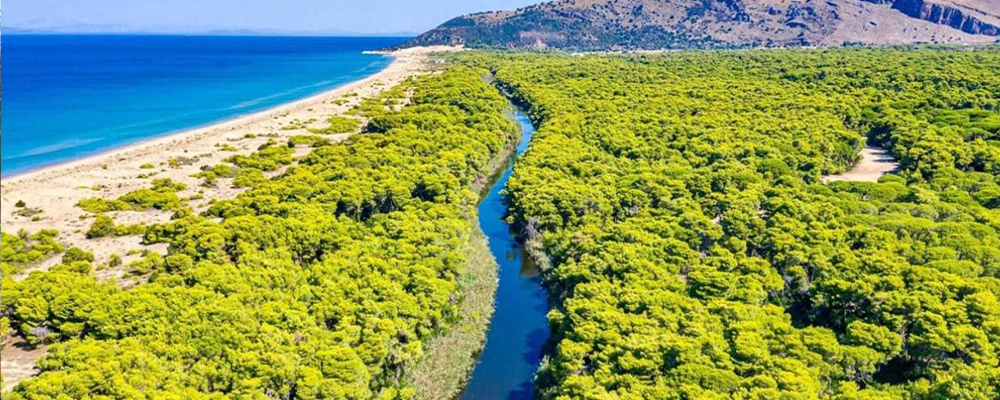
Etoloakarnania occupies the Western part of Central Greece and is one of the Prefectures that make up the Region of Western Greece. It arose from the union of the geographical regions of Aetolia and Acarnania, regions with a rich history lost in the depths of the millennia. The capital of the Prefecture is Messolonghi for historical reasons, while the largest city is Agrinio. Other large cities are Nafpaktos, Amfilochia, Astakos, Vonitsa, Thermo, Aitoliko. Prefecture having an area of 5,461 sq. kilometers and a population of 220,000 inhabitants, it is the largest Prefecture in Greece and sixth in population, gathering 2.2% of the country’s population, while it produces 1.6% of the Aq. National Product.
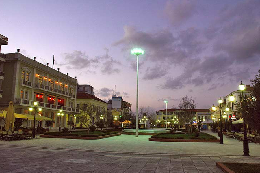
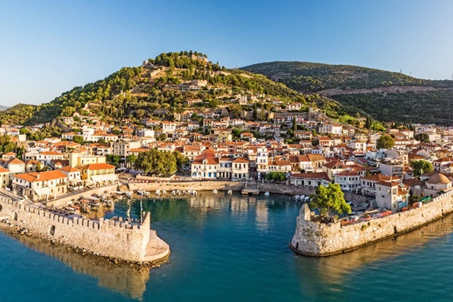
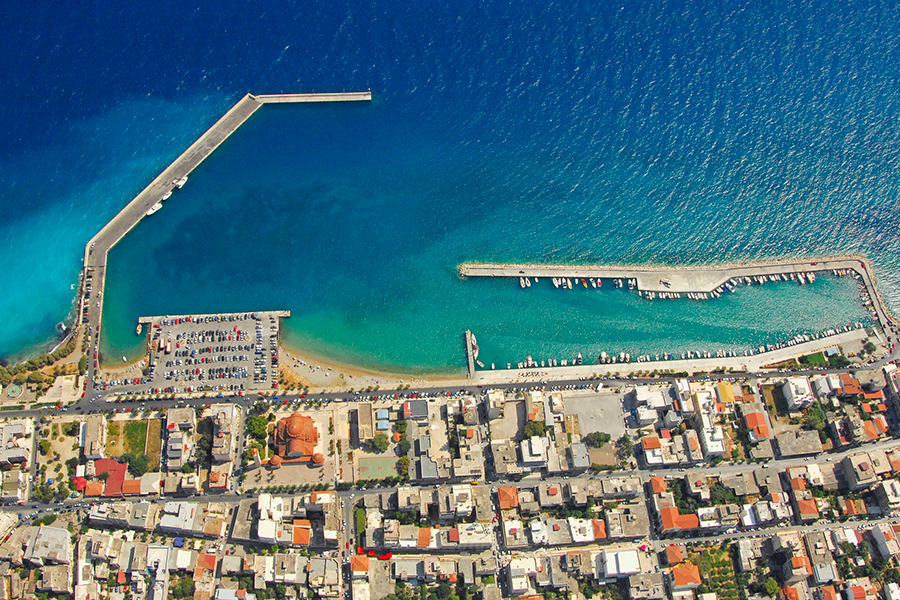
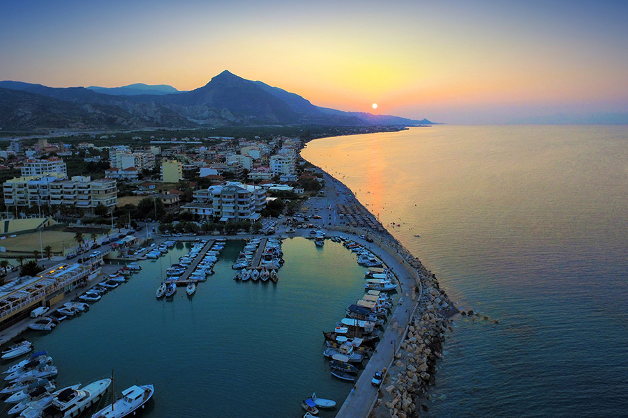
Nafpaktos
Nafpaktos, a beautiful town, built amphitheatrically on a pine-covered slope, with 18,231 permanent residents, is 42 kilometers from Messolonghi and 10 kilometers from the Rio – Antirrio ferry, has for many years preserved, to a large extent, its traditional style. The old circular harbor with the two picturesque towers at its entrance fascinates even the most demanding visitors. The well-preserved Venetian castle, with its successive rows of walls at the top of the hill, is one of the most beautiful in Greece and a real gem for the city. The visitor will find taverns, restaurants, ouzo, cafes in the center of the city, on its beaches or on the hill of the castle overlooking the sea. East and west of the city there are two beaches, the one-kilometer-long beach of Psani, with its large plane trees, luxury shops and the beautiful municipal beach, and the beach of Gribovo, with its huge centuries-old plane trees, with modern hotels, cafes and restaurants.
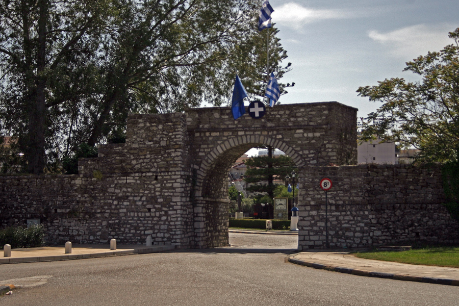
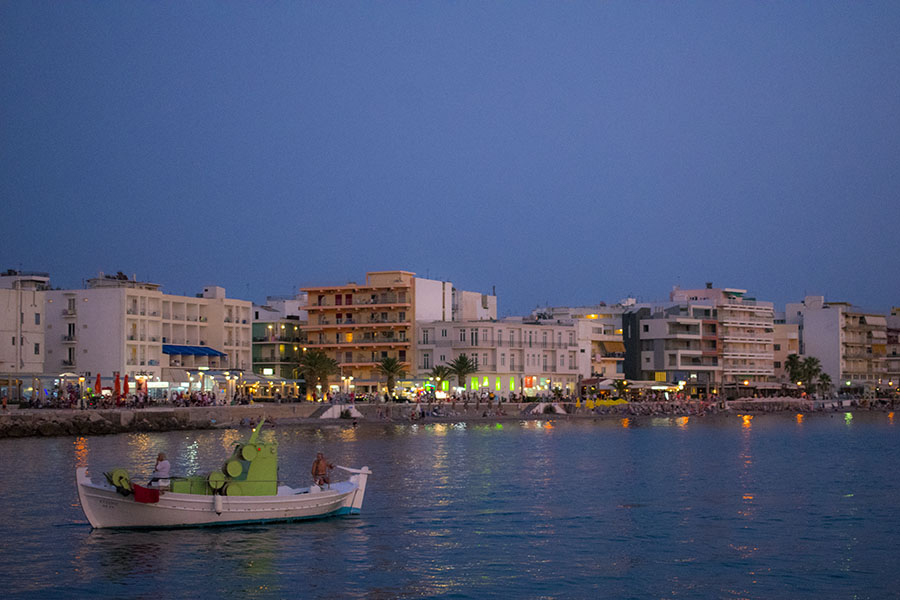
Messolonghi
Messolonghi (officially, the Holy City of Messolonghi) is the capital of the Prefecture of Etoloakarnania and is located in the Southern part of the Prefecture, between the rivers Acheloos and Evinos. It is a historical Municipality, as some of the most dramatic moments of the Greek Revolution of 1821 took place in the city, the two Sieges and the Exodus of Messolonghi.
Messolonghi is also known for its fishing products, especially roe, since the adjacent lagoon is an ideal place for fish farms. The lagoon with its picturesque “pelades”, the small wooden houses on stilts in the water, is protected by the well-known RAMSAR convention and is an environmental park and ecosystem. According to the 2001 census, Messolonghi has 18,121 inhabitants.
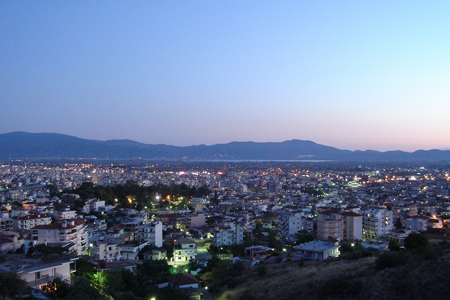
Agrinio
Agrinio is the link city that connects Aetolia and Acarnania and is one of the largest cities in Western Greece. It experienced a large increase in population in the last decades with the attraction of Epirotians, Evrytanians, Trichonians and Akarnanians, but also earlier, when in the 1920s, it received refugees from Asia Minor who had a decisive influence on the life of the city. The city has a population of 63,000 according to the latest census data of 2011, on a total area of 163,000 hectares. The actual population of Agrinio is estimated at 90,000. At this point we must emphasize that only 50% of its real population is recorded in the city.
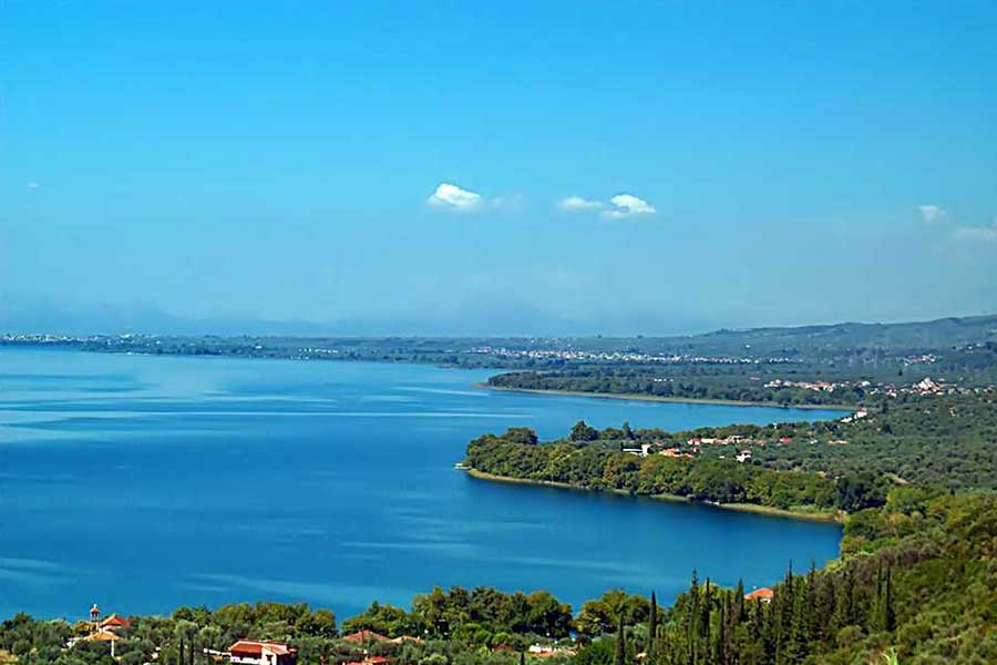
Lake Trichonida
The lake was created long ago, at the end of the Pleistocene, as a result of complex processes from tectonic movements, sedimentation, the action of rivers. The lake maintains its natural and water richness, despite all the pressures it receives from agricultural and livestock activities, but also from urban waste and manages to cope adequately, because it quickly renews its waters, which are important in terms of volume, transparency and oxygenation.
About 200,000 acres are irrigated with its waters, while there is also significant fish production. The waters of the surface runoff of the mountain ranges of Panaitolikos and Arakynthos are the main source of feeding the hydrological basin. To the obvious natural beauty of the area, is added its great biodiversity and its rich birdlife. On its banks there is a rich vegetation of plane trees, willows, reeds and oleanders. Its waters are home to 25 species of fish, 11 of which are endemic to Greece, with the most typical species being the cherukla, the strosidi, the acorn, the eel, etc.
But what makes Trichonida stand out from all the lakes is that it still remains one of the cleanest lakes in Greece with great ecological value and is characterized as one of the most important habitats in Greece.
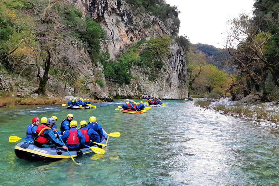
Evinos River
Evinos is a river of Etoloakarnania prefecture. It owes its name to the king of Aetolia Evinos, who drowned in its waters chasing Ida, who had kidnapped his daughter, the princess Marpissa. Evinos is ideal for sports activities such as canoeing and rafting. In the area of the Bania Bridge, modern facilities have been created, the most complete in Greece after the corresponding Olympic ones in Athens. Visitors to the Evinos area are also involved in hiking, mountain climbing, mountain biking and horse riding.
It is a prefecture that is located and unites the two great Greek seas of the Aegean (Saronic Gulf) and the Ionian (Corinthian Gulf). It is located in the northeastern part of the Peloponnese and has a population of 145,082 inhabitants according to the 2011 census. Its capital is historical Corinth with 30,176 inhabitants.
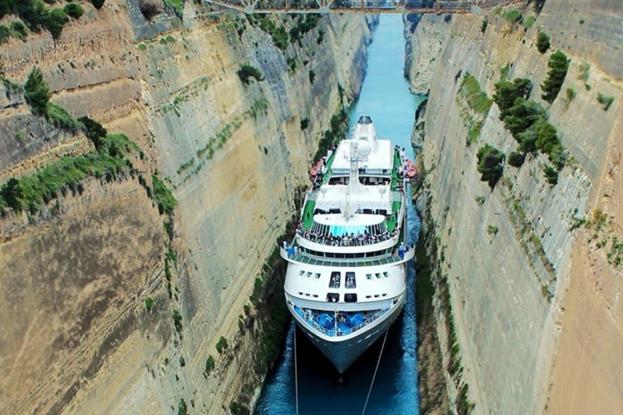
Corinth Canal and Diolkos
In ancient times, between the wall of the Isthmus and its enclosure there was the diolcos, a road through which goods and small ships were transported to avoid the circumnavigation of the Peloponnese. The Corinth Canal is the canal that connects the Saronic Sea with the Corinthian Gulf, at the location of the Isthmus of Corinth, a little east of the city of Corinth. The canal is 6,346 m long, 24.6 m wide at the sea surface, 21.3 m deep at the bottom, while its depth varies from 7.50 to 8 m. Every year 12,000 ships pass through the canal.
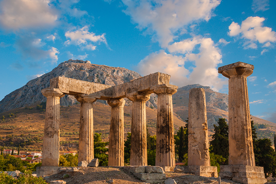
Ancient Corinth
Ancient Corinth was an important city-state of the ancient Peloponnese. It controlled the critical position of the Isthmus and was the most important commercial hub of the ancient world, until it was threatened by Athens. Corinth was considered the richest city in the ancient world. Ancient Corinth was built at the foot of Acrocorinthos, the rocky hill located southwest of the modern city.
Loutraki
Loutraki is a town in the prefecture of Corinthia. It is 84 kilometers from Athens and 4 kilometers from Corinth and during the 2011 census it had 11,564 inhabitants. It is a recognized spa town since 1925, a tourist resort known for its thermal baths, its mineral waters and its casino. It is washed by the Gulf of Corinth, and is the seat of the municipality of Loutraki-Perachora-Agios Theodoros, while the Geraneia mountains dominate the city. It is located in the geographical department of Peloponnese.
In ancient times the area was known as Peraia land and in the place of Loutraki was the ancient town of Thermes or Thermai, known since ancient times for its thermal springs. The current name of Loutraki is due to its thermal springs – baths.
Loutraki is a municipality of the Prefecture of Corinthia, together with Perachora – whose port it was originally – Agioi Theodorou, Isthmia, Poseidonia, Schino, Pisia and the holiday settlements around and near Lake Vouliagmeni.
Loutraki has a 3.5 km long beach that starts from the Corinth Canal and ends at Loutraki Beach Park. It consists of small pebbles and deepens quickly. Many cafes along the beach road provide bathers with sunbeds and umbrellas. Its orientation is west, so bathers enjoy the sunsets behind the coastline of Corinth on one side and Cape Heraion on the other.
Kiato
It has a population of approximately 10,000 inhabitants and occupies most of the coastal part of the Municipality while it is crossed by the Kyrillos and Elissonas rivers. The port of Kiatos is of a commercial nature and serves mainly the export of agricultural products and the import of raw materials for the crafts of the wider region. Tour the beautiful villages and homesteads located near Kiato. Routes by the sea, in fertile plains or in pine-covered areas. You will be surprised by the natural beauties of the place, you will be “enslaved” by the hospitality of the people, you will taste traditional and local products and you will definitely leave with the promise of coming back again soon.
Vrachati
Vrachati is a seaside town in the municipality of Velos-Vochas in the prefecture of Corinthia. It is located 12 km west of Corinth. The toponym has its origin from the name Vrachatis which indicates the area that belonged to an Ottoman aga of the same name called Vrachat. It is located on the old Corinth – Patras national road and is a popular tourist destination. It is known for the festival of Agia Paraskevi on July 26.
Xylokastro
Xylokastro is a seaside town in the regional unit of Corinthia. It is the seat of the municipality of Xylokastro – Eurostini. Every summer it receives thousands of visitors and is one of the most important tourist destinations in the Peloponnese. Points of interest are the pine forest of Pefkia and the beaches of the area. It is 120 kilometers from Athens and 94.6 kilometers from Patras. Xylokastro got its name from a wooden barracks in the area where an observatory operated during the years of the Venetian occupation.
The beauties are many with unique changes in the landscape, the beach road of the town of Xylokastro is ideal for walking at any time of the year as well as the bike path along the beach is an enjoyable experience for bike lovers.
Lake Doxa
Limni Doxa is an artificial lake at an altitude of 900 meters, which is located in the Feneo region of Corinthia. The construction of the dam was completed in the late 1990s and the lake is formed by water flowing from the mountains above. It got its name Doxa from the small river that started in the area and ended in sinkholes near Mount Saita, in the South of the Feneos plateau. The area of the lake, which has been declared a NATURA area, is of particular natural beauty and receives many visitors. From the shores of Lake Doxa starts one of the most beautiful trails in the mountainous Peloponnese that passes through a dense fir forest and reaches the peak of Durdouvana at 2,109 meters. The Capelinian fir and black pines are an ideal refuge for the wild life of the area. Here, waterfowl and small birds set the pace, frogs, turtles, lizards, but also deer, jackals and wild boars are just some of the residents and visitors around the lake. On your walk to the lake you will meet the producers of the area who set up their shop from the morning and treat the visitors to honey, cheese and sourdough bread.
A horse ride along the lake, on paths or forest roads, swimming in the waters of Doxa, and even a bike ride – choose the electric one so you don’t get tired uphill – to admire the scenery is recommended. For the more dynamic, we recommend mountain bikes and lake bikes. When you get tired, visit one of the local taverns in Feneo and try well-cooked local meats, poultry, pulses from local raw materials.

VIP Van Service
VIP Van Service
A transfer service is provided from Araxos airport or Eleftherios Venizelos with a luxury Van for 8-20 people. Contact us for more information at info@bmwmotorent.gr